Working as a summer research assistant with a faculty member in the Department of Physical and Environmental Sciences at UTSC can be a wonderful way to gain experience, knowledge and insight into what students might expect if they choose to pursue graduate studies. The CRESS summer research program started in 2021. Here's what some previous research assistants have said about their experiences:
Spending the summer contributing to one of the projects at CRESS was truly a great experience and change of pace in my university journey. Researching on the topic of Arctic Amplification, I was able to learn how to utilize programming codes to analyze climate data from a variety of climate models, as well as understand the complexity of the atmosphere. This 4-month program not only gave me the valuable exposure to research in the environmental sciences, but also helped my polish and grow important management skills, that would be much need in the professional industry.
- Patricia Lumanto
In my summer research term at CRESS, I had the opportunity to observe and partake in various aspects of a research project, which spans from familiarizing myself with the literature to directly contributing to the project. In particular, I conducted extensive tests on the suite of codes that are used to perform computational fluid mechanics, numerical modelling, and implemented various types of models on Compute Canada’s SciNet high-performance computing cluster. This experience allowed me to develop my scientific toolkit and to realize what I find engaging in scientific research, which in consequence enabled me to plan the rest of my undergraduate years in accordance with a more accurate and better articulated understanding of my own interests.
- Pejvak Javaheri
I thoroughly enjoyed my summer with CRESS, where I got to experience the life of an academic researcher and contribute my part to the scientific world! With Professor Heron, our team modelled the process of continental rifting that separated Canada and Greenland around 60 million years ago using Computer Canada’s Niagara supercomputer. The four months of funded research taught me many valuable skills beyond what the typical undergraduate curriculum offers, such as how to perform calculations remotely on supercomputers, how to write and publish reports and scientific papers, and how to effectively communicate science to different audiences. These skills are not only important for future graduate studies skills but also are easily transferable to the industry. Summer research with CRESS is definitely a great addition to your resume and undergraduate experience.
- Alan Yu
Applications and Projects for 2023
The following research projects are available for the summer of 2023. The associated pay is $7500 for a 12 week period of 35 hours per week. The start and end dates are to be determined by the project supervisors as are any break periods. The 12 working weeks must fall in the May-August period.
Applications should be submitted by email to: cress.utsc@utoronto.ca by March 3, 2023.
Applications should include an attached student transcript, a statement of interest clarifying the project being applied for, why the applicant is interested in this particular project and why the applicant is qualified to undertake the described project and a resume. Statements are limited to a single page. Applications for more than one project are welcome but each project will require a separate (e-mail) application. All submitted files should be in pdf or .docx format.
Inquiries may be sent to Professor Julian Lowman at cress.utsc@utoronto.ca and should include "inquiry regarding CRESS summer project" in the subject heading.
|
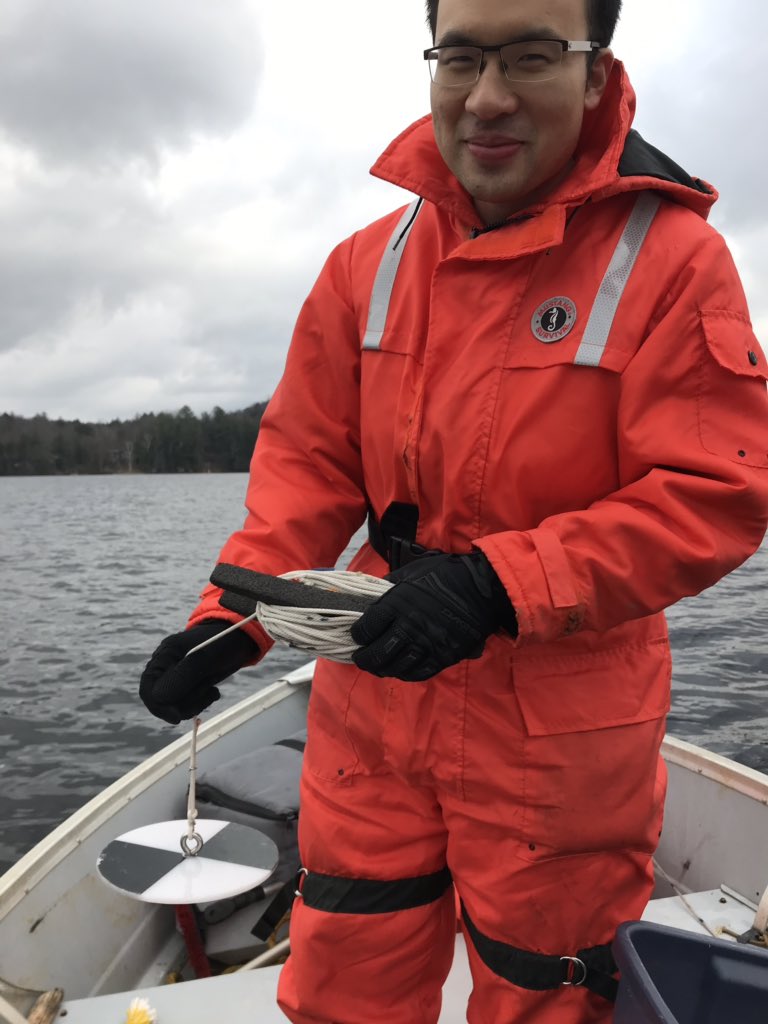
Analyzing water quality trends in Ontario Lakes The student will look at a large data-set of 200+ lakes from Algonquin park and the Muskoka region. The depth of the thermocline varies between these lakes, as does the value of dissolved oxygen levels. The student will test various hypothesis about lake geometry and nutrient levels. For instance, lakes that are large tend to have deeper thermoclines than lakes that are small, due to wind sheltering effects. Lakes which are only slightly deeper than thermocline tend to be more susceptible to have low oxygen levels. Students will need to have a good math and stats background for this project. Supervised by Prof. M. Wells. |
|
Assessing the potential for bacterial evolution across Ontario’s soils Bacteria are central to many global biogeochemical cycles and, by oxygenating the atmosphere, caused one of the most dramatic global change events in Earth’s history. Today, bacteria are both a recipient and accelerant of human-caused global change. Although we know that bacteria can evolve rapidly, most studies of microbial evolution have been performed on a few model types, so our ability to predict near-term bacterial change in real soils is almost non-existent. In this project, the selected student will create a culture collection of bacteria from diverse Ontario soils, which will then be used to compare the evolutionary responses of bacterial types to environmental change. The selected student will work primarily in the lab, developing skills in bacterial culture, analyses of bacterial growth, and basic sequencing and analysis. Strong organization and data recording skills are essential. Previous coursework in microbiology will be considered an asset. Supervised by Prof. T. Bell. |
|
The impact on global heat loss of heterogeneous chemistry in the Earth's deep interior Plate tectonics, and its many manifestations, is a surface expression of convection in the Earth's mantle. For several decades, seismic tomography has been accumulating evidence that the deep mantle is not compositionally homogeneous. This project shall investigate the feedback between a compositionally anomalous and intrinsically dense component in the deep mantle and surface heat loss (relative to core heat loss), using a state-of-the-art parallelized numerical model of mantle convection. The project will be entirely computational in nature and will require running simulations on the Digital Alliance Canada's high performance computers in consultation with the Principal Investigator, Prof. J. Lowman. Student responsibility will entail the submission of job scripts and the post-processing of data. Interested applicants should be enrolled in a Physics or Geoscience Program and have a strong interest in Earth and Planetary Science and some knowledge of a programming language like Python, or an equivalent tool. |
|
Deep earthquakes - a lone wolf event or a trigger for shallower shaking? Although earthquakes primarily happen on or near modern plate boundaries, a small number occur within stable continental interiors (intra-plate earthquakes). Earthquakes that are even less frequent are ‘deep’ intra-plate earthquakes, which occur at a depth greater than 30 km. The understanding of why modern deep intra-plate earthquakes occur is a major challenge given their infrequency and location from the surface. A hypothesis is that deep latent structures related to ancient plate boundaries could reactivate, and potentially trigger shallower earthquakes. However, this hypothesis has never been formally tested with respect to recent earthquake events. For this project, the successful student will first learn about earthquake dynamics and hazard analysis, and then use data science techniques to review the historical earthquake catalogue to identify any trends linking deep and shallow events (focusing on events in Eastern Canada and Central China). The work will use python to try and create an advanced visualization platform (e.g., an interactive map) and will also look to further the skillset of the applicant in the art of science communication. We seek applicants with an interest in earthquakes, plate tectonics, data science, and communication to join Prof P. Heron’s team for (mostly) remote working between May - August 2023. |
|
A new Glacial Map of Canada Canada’s Pleistocene ice age legacy is complex and on a continental scale presents challenges that no other country faces in understanding how glaciated landscapes evolved and how their geology can guide development of natural and human resources. The last glacial map of Canada was produced using air photographs in 1967 and is now outdated. Knowledge is is now more than 50 years old and does not meet current demands. The recent availability of high-resolution digital imagery (e.g., ArcticDEM, NRCan’s new HRDEM, SRTM DEM, LiDar, etc.) and the development of machine learning techniques to rapidly analyse such data now allows Automated Mapping. A new glacial map of northern Canada will drive future innovation in mineral exploration, assist in groundwater resource mapping, including permafrost, and guide development in the north in a warming climate. This will be conducted at UTSC in the Eyles lab and provides opportunities for undergraduate training in the analysis of ‘big data.’ We seek enthusiastic individuals willing to join our team for summer 2023. This is part of a larger 5-year project with the Geological Survey of Canada and there are excellent opportunities for preparing undergraduate students for graduate studies. |