Town/City:
|
Honolulu
|
State/Province:
|
Hawaii
|
Country:
|
U.S.A.
|
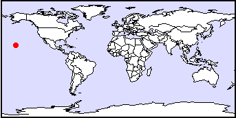
Latitude/Longitude:
|
157°5N 21°5W
|
Information supplied by
Janet
Dated Tue Dec 22 00:13:43 1998 |
There are two submitions for this
city.
To see the second submition click
here.
Information Topics:
City Description:
Honolulu (meaning sheltered harbor)is the principal city and capital of
Hawaii, located on the Oahu island. The airport at Honolulu is the most
important one in the Pacific. It is a port for ships en-route from the
west coast of North America to Antipodes and to the Orient. Honolulu became
the most important shipping point in Hawaii. It flourished with the sandalwood
export and then as a re-supply port for whalers, and also from the sugar,
pineapple and light manufacturing industries. The beautiful scenery attracts
many tourists from all over the world to visit Honolulu, giving rise to
its economy and popularity. It has been estimated with modern archaeology
that settlement in Honolulu may have begun about 1100 A.D. The population
is approximately 880 000 (estimate from 1997) and the total land area of
Honolulu is 600 square miles (1560 square kilometers).
Back to Topics
Climate:
Honolulu is situated in the subtropics giving it a mild climate. The temperature
usually varies between 21° C to 32° C with an annual mean temperature
of 24.3° C. The climate varies little from season to season. In addition,
Honolulu is characterized by tropical rain forest climates. This city is
constantly moist and warm. The annual rainfall averages about 560 mm, the
most important source of rainfall results from orographic lifting over
the volcanic mountains. The sun is high in the sky all year, resulting
in Honolulu's relatively high average solar radiation intensity (approximately
180 00 calories per square centimeter). The longest day in Honolulu receives
about 13 hours 20 minutes of daylight and the shortest 10 hours 50 minutes.
The trade winds (winds from the northeast and southeast that converge in
the equatorial low pressure trough, forming the intertropical convergence
zone) in Honolulu vary over the year. They are most common in the summer
and least during the winter. This contributes to the steady winds, pleasant
temperatures and humidities, and a strong diurnal variation of clouds and
rainfall. However, when the trades fail, the weather becomes unpleasant
with variable winds, high humidities, and heavy rains, and other severe
weather patterns.
Back to Topics
Basic Hydrogeology:
The Honolulu region consists of lava flows interbedded with ash deposits
segmented by dikes. The maximum sediment thickness in the Honolulu area
was found to be over 1000 feet. The permeability of the sediments varies
widely, but the overall effect of permeability is lower compared to the
basalts. The overall low permeability of the sediments act as a caprock
retarding the seaward movement of fresh groundwater from the more permeable
underlying basaltic aquifers. Also, compared to the basaltic aquifers the
capacity of the sediments to store and transmit water is small. Due to
the different lava flows and varying permeability of the sediments, the
aquifers are very heterogeneous. Furthermore, the coastal sediments contain
large quantities of water, varying from fresh to sea water. Most of the
groundwater recharge is through precipitation and applied irrigation. Rainwater
percolating through the rocks may accumulate in three principal types of
groundwater bodies. The first type of groundwater are the high-level bodies
perched on ash beds or soils interbedded with flows, on unconformities,
or on other relatively impervious lava flows, such as the dense cores of
aa flows. The second type is the high-level bodies impounded within compartiments
formed by impermeable dies that have intruded the lava flows. Finally,
there are basal water bodies floating on and displacing salt water. Types
of groundwater occurrence in Honolulu area are fresh basal water and salt
water separated by a transition zone. The basal groundwater can be confined
or unconfined. Confined basal groundwater is usually with low permeability
coastal plain sediments such as ash, also known as caprock locally. The
unconfined basal water can be collected by horizontal skimming tunnels
(called Maui tunnels) at sea level. Different types of groundwater development
to capture the ground water by skimming is to prevent saline-water encroachment.
Furthermore conventional wells are also used to pump out the salt water.
The basal groundwater body in Honolulu is capable of producing exceedingly
large discharges due to its thickness, thus most groundwater is developed
from the basal groundwater body. The groundwater recharge and draft is
approximately 85 million gallons per day and 56 million gallons per day,
respectively. Possible reduction in recharge rate maybe due to high evapotranspiration
from shallow water levels and runoffs. The main source of groundwater in
Honolulu comes from the Koolau aquifer. This aquifer is within the Koolau
Basalt of Pliocene and Pleistocene age. Water potable sources in the Honolulu
District are 41 wells (39 active), 2 shafts (one not in use), gravity systems
(2 springs sites and 4 tunnel systems). The water storage system in Honolulu
district consists of 66 reservoirs of 52.37 million gallons capacity.
Back to Topics
Water Use:
Groundwater is the most valuable mineral resource, without it there would
be no tourist business, and no sugar industry. A lot of the water is being
used towards (both furrow and drip) irrigation for sugarcane since it takes
approximately 1 ton of water to make 1 pound of sugar. Honolulu consumes
about 130 million gallons of water per day through wells and springs. Consequently,
a lot of the water use is from residential, agriculture, industrial/commercial
area. Honolulu consumes a fair amount of water because it is here where
a lot of the population and agriculture is concentrated.
Back to Topics
Groundwater Issues:
Although most of the groundwater development involves searching for highly
permeable formations; here, the strategy involves looking for low permeability
formations to act as barriers blocking the escape of fresh groundwater
into the Pacific ocean. The drinking water supply in Honolulu is monitored
for salt content and bacteria (disinfecting if necessary). Also different
tests are conducted to ensure that the water is not contaminated and to
meet the maximum allowed contaminant levels set by the U.S. Environmental
Protection Agency. This level is set at which no significant health effects
would occur if the water were to be consumed for an entire lifetime. These
tests include detection for trace metals (such as lead). However, there
maybe some contaminants in the drinking water which have not been discovered
and regulated.
Back to Topics
Groundwater Problems:
As Honolulu is being urbanized extensively, the possibility of contamination
by different chemicals also increases. These contaminants in the drinking
water may not have been discovered thus increasing the potential threat
to the publics health. These health effects may cause acute or long-term
effects, perhaps involving carcinogenic or non-carcinogenic effects. As
Honolulus population increased with agriculture and expansion of urban
areas, the demand for freshwater resource has also increased significantly.
Thus the number of wells increased.
Back to Topics
Solutions:
Presently, to monitor the number for wells and contamination problem, Honolulu
Board of Water Supply regulates the construction of new wells to minimize
the possibility of leakage through controls on wall thickness and grouting
between the casing and the drilled hole. Furthermore, more laboratories
can collect and analyze thousands of water samples each year to assure
compliance with strict federal and state drinking water standards. The
procedures and equipment used for analysis are technically advanced, computerized
and capable of measuring extremely low levels of contaminants. Also laboratories
will also monitor bacteria by analyzing many samples to detect the possible
presence of disease-causing microorganisms. The possibility of salt water
intrusions are being monitored with treatment plants operations. Thus providing
important data for the efficient use of water resources and protection
of the island's groundwater aquifers. Also evaluation on the quality, improvement
and approval of the new water sources maybe reinforced.
Back to Topics
References and Other Author(s):
The Estate of James Campbell and Water Resources Research Center University
of Hawaii at Manoa (1981), Groundwater in Hawaii. : A Century of Progess.
Water Resources Research Center, p.15-49 81.
P. J. Shade and W. D. Nichols (1986), Regional Aquifer-System
AnalysisOahu, Hawaii: Water Budget and the Effects of Land-Use Changes
on Ground-water Recharge, Oahu, Hawaii. , p. C1 -C37.
C. W. Fetter (1994), Applied Hydrogeology. Prentice
Hall, p.359,361.
Harold T. Stearns (1985), Geology of the State of Hawaii. Palo Alto,
California, p. 27-31.
Marie Sanderson (Ed. 1993), Prevailing Trade Winds: Weather and Climate
in Hawaii. University of Hawaii Press, p. 1-10, 60, 75-76.
Back to Topics
Contacts:
Back to Topics