|
|
|
|
|
|
Town/City: |
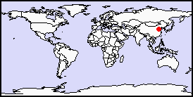
Tianjin |
State/Province: |
Hubei |
Country: |
People’s Republic of China |
Latitude/Longitude: |
39N 117E |
Information supplied byLouisa Chan98chanlo@utsc.utoronto.ca |
|
Tianjin is one of the 4 municipalities directly under the Central Government of the People’s Republic of China, and it is the third largest city in the country only after Beijing and Shanghai. The population of Tianjin is 9.5 million (Tianjin Government Administration Net). It is located in Northeastern China, sitting on the downstream portion of the Haihe Basin in northern apex of the Great North China Plain (Hou, 1999). The total area of Tianjin is 11919.7 square kilometers. The length from south to north is 189 kilometers and the width from east to west is 117 kilometers. The Bohai Sea is on its east and the Yan Mountain is on its north. Tianjin is 137 kilometers southeast of Beijing, thus it is known as the gate of the capital in geography. In the past, most areas of Tianjin used to be a vast ocean. As time passes, it gradually became flatland after the sea water fell and the entrance of Haihe River moved to the north for three times and a large amount of silt left to make the coastline move to the east (Tianjin Government Administration Net).
There are 18 districts and counties in Tianjin, including 6 city center districts: Heping, Hexi, Hebei, Hedong, Nankai and Hongqiao; 4 town districts: Dongli, Xiqing, Jinnan and Beichen; 3 seashore districts: Tanggu, Hangu and Dagang; and 5 counties: Wuqing, Ji County, Ninghe, Baodi and Jinghai. The height above sea level of Tianjin is falling gradually from the north mountain area of Ji County to the south flatland. It is sloping from the west of the end of the alluvial fan of the Yongding River to the east of the Wuqing County which formed the geomorphologic features of higher in the north and lower in the south; higher in the west and lower in the east. The geomorphologic type can be divided into four, as mountain, hill, flatland and seacoast. The most areas are flatlands with the highest nine mountain area of 1085.5 meters above sea level and the lowest Dagukou area of Tanggu District of zero meter above sea level (Tianjin Government Administration Net).
The climate in Tianjin is warm, semi-humid, semi-arid and monsoon with typical features of the warm temperature zone. The average temperature in the whole year is 12.3oC. The average temperature in the hottest July is 26oC and the record for the highest temperature was 39.7oC on July 4th of 1972. The average temperature in the coldest January is –4oC and the record for the lowest temperature reached –22.9oC in 1966. The annual waterfall is 561.3mm (Tianjin Government Administration Net).
Tianjin is located on a geologically recent flat coastal plain overlying a thick multiple aquifer alluvial sequence. The uppermost aquifer is rackish and is separated by a clay formation from underlying freshwater aquifers, which are extensively pumped. The upper part of this multiaquifer system is highly underconsolidated and experiences natural compaction rates of 1-3 mm/year (Foster et al., 1998).
Tianjin relies in groundwater for about 30% of its water supply (Hou, 1999). Regionally, agriculture remains the major groundwater user, with estimated total pumping of 600-700 Mm3/year (Foster et al., 1998).
With population growth and expansion of the economy, water demand has increased dramatically over the past two decades. Domestic water use is probably rising at the quickest rate in Tianjin, as the household consumption per capital has risen from 28L per day per person in 1949 to 240L per day per person in 2000. Industrial water demand has also risen in absolute volumes. In the last 15 years, water demand by industry has increased 57.5%. As surface water is being contaminated by upstream Beijing’s activities, water supply in Tianjin would be relying more on groundwater as a water source (Hou, 1999). However, groundwater use remains inefficient, resulting in regional overabstraction and inefficient allocation of scarce high-value good resource (Foster et al., 1998).
Because of the increase in water demand, over-pumping has led to the continuation of land subsidence, as well as the falling of water tables in Tianjin and its nearby areas in northern China (Zhang, 2000). Groundwater levels in the North China Plain have been dropping 1 to 2 meters per year. Near the city, the groundwater table has dropped by more than 60 meters. Nevertheless, according to the Nanjing Institute of Hydrology and Water Resources, China’s demand for water will increase by 21% from 2000 to 2010. Thus, as a major industrial and commercial center of the country, the city is facing considerable challenges in supplying the water it needs to develop its current and future economy (Wiberg, 1999).
Foster, Stephen, et al. Groundwater in Urban Development: Assessing Management Needs and Formulating Policy Strategies. Washington: The World Bank, 1998.
Hou, Eve. 3x3 Beijing Tianjin Water Resources Management Project. University of British Columbia, 1999.
Tianjin Government Administration Net
Wiberg, David. Planning and Managing China’s Water Resources. International Institute for Applied Systems Analysis, 1999.
Zhang, Zhongsheng. Severe Drought Highlights China’s Water Scarcity. China2000, July 2000.