Town/City:
|
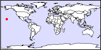
Honolulu
|
State/Province:
|
Hawaii
|
Country:
|
USA
|
Latitude/Longitude:
|
21:19:02N and 157:48:15W
|
Information supplied by
Taskin Shirazi
Dated Tue Dec 7 10:40:10 1999 |
Information Topics:
City Description:
Honolulu is located at 21:19:02N latitude and 157:48:15W longitude and
lies 5 m above sea level. The city is Hawaii's capital and its centre of
business, culture and politics. It has a population of nearly 400 000,
which is about a third of the population of the entire state of Hawaii
(Bendure and Friary, 1997). Honolulu extends along the south-central shore
of Oahu, the third largest island in the Hawaiian Archipelago. Urban Honolulu
occupies approximately 218 km2, nearly 15% of Oahu's total land
mass. The island's extreme length is about 71 km, and its width 48 km (Bendure
and Friary, 1997). Oahu has a 5% unemployment rate (Bendure and Friary,
1997). Tourism is the largest sector of the economy, accounting for about
30% of Oahu's jobs. It's followed by defense and other government employment
which together account for 22% of all jobs. Nearly one-fifth of Oahu is
still used for agricultural purposes, mostly for growing pineapples. Sugar
production, no longer profitable on Oahu, was phased out entirely in 1996
(Bendure and Friary, 1997).
Back to Topics
Climate:
Mild temperatures and moderate to high humidity that varies diurnally from
about 60% -90% at most locations characterize the subtropical climate of
Oahu. Honolulu's climate is typically warm and sunny. It's unusually pleasant
for the tropics, as near-constant northeasterly trade winds prevail throughout
the year. Although there can be periods of stormy weather, particularly
in the winter, much of the time the rain falls as short daytime showers
accompanied by rainbows. In Honolulu, the average daily maximum temperature
is 29 C and the minimum is 21 C. Temperatures are slightly higher in the
summer (May-October) and a few degrees lower in the winter (November-April).
Rainfall varies greatly with elevation, even within the city. Waikiki has
an average annual rainfall of only 640 mm, whereas Manoa Valley (at the
north side of Honululu) averages 4010 mm (Bendure and Friary, 1997).
Back to Topics
Basic Hydrogeology:
Oahu and the other Hawaiian Islands are the exposed peaks of large volcanic
mountain ranges, most of which lie beneath the sea, that constitute the
Hawaiian Ridge. The island of Oahu is formed by the remnants of two coalesced
shield volcanoes, the Koolau Volcano to the east and the Waianae Volcano
to the west. The Waianae Volcano is older than the Koolau and both volcanoes
likely erupted at the same time during at least part of their active lifespans.
The shield-building lavas emanated mainly from prominent rift zones of
the two volcanoes. Near the end of the growth of the shield, the summits
of the volcanoes collapsed and formed calderas. After a long period of
subsidence and erosion, eruptive activity resumed at scattered vents at
the southern ends of the Koolau and Waianae Ranges (Nichols et al. 1996).
Rocks of the Waianae rejuvenated stage are called the Kolekole Volcanics
and those of the Koolau rejuvenated stage are called the Honolulu Volcanics
(Nichols et al. 1996). Honolulu Volcanics are limited in areal extent,
occurring only near the southeastern end of the Koolau Range. The rocks
are strongly alkalic and range in composition from alkalic basalt, basanite,
and nephelite to melilitite. A large proportion of the rocks are pyroclastic
products such as ash, cinder, spatter and tuff. Eruptions inland from the
coast left deposits of black ash and cinder and produced lavas that flowed
down valleys and spread out over the coastal plain. Potassium-argon ages
for the Honolulu Volcanics range from 0.9 to 0.03 Ma (Nichols et al. 1996).
A flat coastal plain composed of sedimentary deposits, referred to as caprock,
surrounds much of Oahu. The caprock varies in width from a narrow marine
terrace to a broad plain several miles wide. Where it is extensive, such
as in southern Oahu, its surface is composed mainly of emerged Pleistocene
reefs and associated sediments (Nichols et al. 1996). Although the Hawaiian
Islands are surrounded by seawater, favourable circumstances cause the
islands to be underlain by large quantities of fresh groundwater. Foremost
among these circumstances is the role of the island masses in causing orographic
rainfall. Despite the presence of moist oceanic air, mean annual rainfall
over the open ocean near Hawaii is only about 750 mm (Hunt et al. 1988).
The Hawaiian Islands obstruct oceanic winds, causing air to rise and moisture
to precipitate. This orographic effect provides the mountainous uplands
of the larger islands with as much as 7000 to 10 000 mm of mean annual
rainfall (Hunt et al. 1988). Favourable geologic conditions allow much
of the abundant rainfall to accumulate as fresh groundwater. Permeable
soils and rocks permit easy infiltration and subsurface movement of water,
and low-permeability geologic features impound large amounts of water in
thick groundwater reservoirs. If geologic conditions were less favourable,
more of the rainfall would run off to the sea and less water would be stored
as groundwater (Hunt et al. 1988). Although most Hawaiian volcanic rocks
have similar basaltic composition, their modes of emplacement result in
a variety of physical properties that govern their hydraulic properties.
The volcanic rocks are divided into four groups: (1) lava flows, (2) dikes,
(3) pyroclastic deposits and (4) saprolite (weathered material that has
retained textural features of the parent rock) and weathered basalt (Nichols
et al. 1996). Stratified sequences of thin-bedded lava flows form the most
productive aquifers in Hawaii. Lava flows on Oahu, as well as the other
Hawaiian islands, are mainly of two textural types - pahoehoe and aa. Dikes
are thin, near vertical sheets of massive intrusive rock that typically
only contain fracture permeability. Where dikes intrude lava flows, they
inhibit groundwater flow principally in the direction normal to the plane
of the dike. Pyroclastic deposits include ash, cinder and spatter. They
are essentially granular with porosity and permeability similar to that
of granular sediments with a similar grain size and degree of sorting.
Weathering of basaltic rocks in the humid, subtropical climate of Oahu
alters the igneous materials to clays and oxides and reduces the permeability
of the parent rock (Nichols et al. 1996). The thickness of the volcanic-rock
aquifers of Oahu is not known, but probably is at least a 1000 m. This
has important implications for estimates of hydraulic conductivity and
transmissivity derived from aquifer tests because transmissivity is a function
of hydraulic conductivity and aquifer thickness. The lack of a definable
aquifer thickness and the partial penetration of wells introduce ambiguity
into estimates derived from aquifer tests. Estimates of hydraulic conductivity
for dike-free lavas, based mostly on analysis of aquifer tests using the
Thies and Thiem equations, tend to fall within about one order of magnitude,
from about 150 to 1500 m/day (Nichols et al. 1996). Estimates of specific
yield range from about 1-20% percent; most values lie within a narrow range
of about 5-10% (Nichols et al. 1996). Estimates of confined-storage coefficient
typically are higher than the range of 5 x 10⁻³ to 5 x 10⁻⁵
cited for confined aquifers (Nichols et al. 1996). The primary modes of
freshwater occurrence in Oahu are as a basal lens of fresh groundwater
floating on saltwater, as dike-impounded groundwater, and as perched groundwater.
Basal groundwater is water that lies beneath the water table, below which
all permeable rocks are saturated. The freshwater head in a basal water
lens is near sea level. On Oahu, basal groundwater occurs both in volcanic-rock
aquifers and in aquifers in the sedimentary deposits under confined and
unconfined conditions. The thickness of the freshwater lens depends on
recharge, aquifer permeability and the presence or absence of confinement
in the shoreward discharge areas. Recharge to a given basal water body
may occur by direct infiltration of precipitation or streamflow and by
groundwater inflow from upgradient groundwater. Oahu is underlain by a
regional aquifer system composed of two principal aquifers, the Waianae
aquifer in the Waianae Volcanics and the Koolau aquifer in the Koolau Basalt.
The aquifers are composed mainly of thick sequences of permeable, thin-bedded
lavas. The two aquifers combine to form a layered aquifer system throughout
central Oahu, where the Koolau aquifer overlies the Waianae aquifer. They
are separated by a regional confining unit, the Waianae confining unit,
which was formed along the Waianae-Koolau unconformity. In some coastal
areas, caprock overlies and confines the aquifers, impeding freshwater
discharge and impounding basal water to a thickness of as much as 550 m.
Oahu has been divided into seven major groundwater areas based on the occurrence
of deep-seated, structural geohydrologic barriers. Hydraulic continuity
within these seven areas is generally high, and the potentiometric surface
is smoothly continuous, except in rift zones where dikes cause numerous
local discontinuities and where internal barriers cause further disruptions
(Nichols et al. 1996). The southern Oahu area is bounded on the east by
the Koolau and Kauu rift zones, on the north by the south Schofield groundwater
barrier, on the west by the Waianae rift zone, and on the south by the
sea. The area has been divided into six smaller groundwater areas, mostly
by valley-fill type barriers. Each of the areas contains a basal freshwater
lens. The Ewa area on the west is underlain by the Waianae Volcanics and
originally was identified as a separate major groundwater area based on
differences in groundwater levels with the adjacent Pearl Harbor area.
The Pearl Harbor, Moanalua, Kalihi, Beretania (which includes Honolulu)
and Kaimuki areas are underlain by Koolau Basalt and are separated by valley-fill
barriers (Nichols et al. 1996).
Back to Topics
Water Use:
Weathering and erosion have modified the original domed surfaces of the
volcanoes, leaving a landscape of deep valleys and steep inter-fluvial
ridges in the interior highlands. As a result of this, streams on Oahu
are short, with steep gradients and small drainage areas. Main courses
of streams generally follow the consequent drainage pattern established
on the original domed surfaces of the shield volcanoes. Lower-order tributaries
branch off from the main courses in a dendritic pattern. Steep terrain
and steep stream gradients cause water to run off rapidly following precipitation.
As a result, streamflow is characteristically flashy, with high flood peaks
and little baseflow. Few streams are perennial over the entire reach. Streamflow
is perennial at high altitudes where precipitation is persistent and near
sea level where streams intercept shallow groundwater. These conditions
virtually preclude surface-water development on Oahu and lead to heavy
reliance on groundwater (Nichols et al. 1996). Groundwater pumpage from
all sources averaged about 394 million gallons per day (Mgal/d) in 1980.
Of this, about 81%, or 318 Mgal/d, was pumped from the volcanic-rock aquifers
of the island, with 238 Mgal/d being pumped from the southern Oahu area
alone. About 19%, or 76 Mgal/d, of the total from all sources was derived
from water-development tunnels, flowing wells and pumpage from aquifers
in the caprock (Nichols et al. 1996). By 1985, at least 1635 wells, tunnels
and shafts had been drilled in Oahu for the development of groundwater
resources. By far, the largest number of wells have been drilled in the
Honolulu and surrounding area, mostly for public supply and irrigation.
Current projections of domestic water demand for Central Oahu, Waianae,
Ewa, and Honolulu are approximately an additional 90 Mgal/d (million gallons
per day) by 2020. Based on current data, Oahu only has 82 Mgal/d remaining
capacity, leaving a shortfall for the projected demand in 2020 (Hawaii's
Drinking Water Resources, 1999).
Back to Topics
Groundwater Issues:
The economy of Honolulu, and indeed of most of the State of Hawaii is dependent
on groundwater for continued growth and prosperity. However, declining
groundwater levels and potential contamination of the island's fresh groundwater
by saltwater intrusion (the invasion of freshwater by saltwater from the
sea or from marine sediments due to groundwater withdrawal) and by organic
compounds are causes for concern regarding the future use of this resource.
Back to Topics
Groundwater Problems:
Land-use changes affect the groundwater system by changing the magnitude
and distribution of groundwater recharge. The major effect of land-use
changes on groundwater recharge is from irrigated agriculture. The excess
of applied irrigation water over evapotranspiration leads to an increase
in recharge from irrigation-return flow. This returnflow often contains
chlorides, nitrates and other chemicals associated with agricultural activity,
which can contaminate the groundwater and make it brackish. It has been
suggested that irrigation flow from furrow-irrigated sugarcane might increase
groundwater recharge by as much as 2000% in areas of mean annual precipitation
of 510 mm or less and by as much as 500% in areas of mean annual precipitation
of 1524 mm (Nichols et al. 1996). Urbanization also leads to changes in
the water budget and changes in groundwater recharge. Most of the urbanization
on Oahu is concentrated in Honolulu. This area receives a mean annual precipitation
of less than 1524 mm. Data given by Giambelluca (1986) indicate that runoff
in urbanized areas such as Honolulu will increase by about 265%. Irrigation
of lawns in urban areas typically leads to increases in evapotranspiration
and, in spite of increased runoff can lead to increases in groundwater
recharge. Groundwater recharge to the non-caprock areas of the island had
increased to 824 Mgal/d. All of this increase of 54 Mgal/d above predevelopment
rates was estimated to have come as a result of land-use changes in southern
and northern Oahu, largely urbanization and agriculture. Estimated recharge
increased by 32 Mgal/d in southern Oahu. Of this increase, 15 Mgal/d was
return flow from irrigated sugarcane and 18 Mgal/d from non-irrigated pineapple
(pineapple reduces natural evapotranspiration); however, there was a reduction
of 1 Mgal/d as a result of urbanization (Nichols et al. 1996).
Back to Topics
Solutions:
Saltwater intrusion, urbanization and agriculture all threaten ground-water
supplies in many of the Hawaiian Islands. A variety of hydraulic and geochemical
techniques may be applied to determine the sources and mechanical causes
of the saltwater intrusion and contaminants from urban and agricultural
runoff. Once the causes are determined, changes in spatial distribution
and quantity of ground-water pumpage, along with surface water deliveries
for artificial recharge, are likely to be required to control intrusion.
Current studies are applying solute-transport and hydraulic-optimization
modeling techniques to evaluate management options for controlling seawater
intrusion and pollution in multiaquifer systems (USGS, 1999).
Back to Topics
References and Other Author(s):
Bendure, G., and Friary, N., 1997. Lonely Planet: Honolulu.Indonesia, Pac-Rim
Kwartanusa Printing, 167pp.
Giambelluca, T.W., Nullet, M.A., and Schroeder, T.A., 1986. Rainfall
atlas of Hawaii: State of Hawaii, Department of Land and Natural Resources
Report R76, 267 pp.
Hawaii's Drinking Water Resources. 1999. www.hawaii.gov/dlnr/DRINKING.HTML
Hunt, D., Ewart, C., and Voss, C., 1988. Region 27, Hawaiian Islands.
In: Back, W., Rosenshein, J., and Seaber, P., (eds)., Hydrogeology. Boulder,
Colorado, Geological Society of America, The Geology of North America,
v. 0-2, p. 263-270.
Lonely Planet Destinations - Hawaii. 1999. www.lonelyplanet.com
Nichols, W., Shade, P., and Hunt, C., 1996. Summary of the Oahu, Hawaii,
Regional Aquifer-System Analysis. U.S. Geological Survey Professional Paper
1412-A.
Back to Topics
Contacts:
William D. Nichols, Patricia J. Shade and Charles D. Hunt Jr.
Regional Aquifer System Analysis - Oahu, Hawaii
United States Geological Service
Back to Topics